


Why biking to work fails when commuting from Renton to Seattle
- Background
- Route 1 - 140th to Renton Transit Center, then bus to SODO
- Route 2 - 192nd St to the Tukwila Sounder station
- Route 3 - Drive to Van Asselt park, bike rest of way
- Overall verdict
- Lessons learned and recommendations
- Related posts about biking
I recently decided to try going carless (at least to work) to see if riding my bike combined with bus/train would work for me. I fantasized about getting a good bike workout while simultaneously commuting to work, but reality quickly set in: the time commitment is too much. This post is about why biking combined with public transportation isn’t practical from Renton to Seattle. It might work for other commute locations, but for me, it doesn’t. I have to remind myself of this, because every now and then I dream about biking all the way into work from my house in Fairwood (unincorporated King County, just outside Renton city limits) to South Lake Union in Seattle.
The main issue is time: any combination of bike + train/bus consumes at least 1.5 to 2 hours each way, or about 4 hours of commuting each day. That’s too much time to maintain any sense of productivity at work. Additionally, the routes are not fully protected bike paths but rather a mishmash of shoulder routes, side streets, and sidewalks — often in car-centric zones that make biking dangerous. If I’m going to spend time biking, I want to ride in enjoyable places.
Background
We used to be a two-car household. My wife drives a Subaru Outback, and I drive a VW Jetta. My commute to work usually involves driving my car to the Sounder train station (a 6.5 mile distance), riding the Sounder (a commuter train) one stop north to King Street Station (20 min.), and then biking the last leg to my workplace in South Lake Union (2 miles, or 20 min). (I once had my commute featured in a spotlight profile for Commute Seattle.) If the train is on time, the commute typically takes 1 hr 10 minutes or so. The multimodal nature reduces some of the tediousness of the commute, and I have time on the train to stretch and time on bike to get some morning exercise.
However, my college-aged daughter in Bellingham wanted my car, and as a way to help them gain more experience and confidence in driving, I decided to give it to them. This meant I was car-less (the other car is my wife’s, which I can’t take all day). I wanted to do more biking anyway. Before buying another car, I decided to run an experiment to see if I could make bike + public transportation routes work. I also wanted to get more biking exercise along my morning commute, in part because a recent bout with plantar fasciitis has made it so that biking is the only really non-painful exercise activity right now. I recorded several logs about three different routes.
I ran these rides in late August, under about the best conditions the year offers here: dry roads, warm mornings, and daylight on both ends of the day. I ride a regular pedal bike (Specialized Sirrus), not an ebike. The times I give for each route are rough — I was experimenting with variations as I went, so some legs took longer than they would once a route settled into a routine.
Some of the details for these routes are unnecessarily specific and probably won’t mean anything if you’re unfamiliar with these areas or where I specifically live. However, I’m hopeful that the details will raise awareness among Renton city officials and the departments of transportation. Regardless of the details, probably a similar situation exists across suburban neighborhoods regardless of location. The bottom line is that bike + public transportation takes too much time. It’s also a complex puzzle to figure out.
Route 1 - 140th to Renton Transit Center, then bus to SODO
| Feature | Assessment |
|---|---|
| Safety | Low |
| Time | ~2 hours each way |
| Enjoyment | Minimal |
This route involves biking the 6.5 miles from the Fairwood area of Renton to the Renton Transit Center, descending the long hill along 140th Way SE.
I rode side streets up to 140th and Petrovitsky (pictured below), which is one of just a few ways to get to an exit path from Fairwood via bike. The intersection near 140th and Petrovitsky is bike-unfriendly, with one car turn lane merging into a bike shoulder lane (see callout #1 in the image). A turning car passed within a couple feet of me here.
Additionally, the bike lane doesn’t continue on the other side of the intersection (see #2), so you have to transition to sidewalks at that point. Unfortunately, there are so many strip-mall intersections along the sidewalk that I’m not actually sure which is more dangerous, the sidewalk or the street.
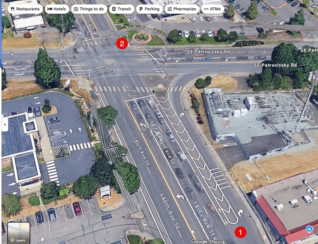
Looking at this intersection from a bike’s POV, you can see there’s a stretch that’s almost like a gauntlet. Many cars turn right here, so you have to hope they see you on a bike and don’t turn into you. I’m not sure what traffic design would avoid this issue, but it’s especially unnerving here — there are no painted lines indicating who wins in this no-man’s-land where both bikes and cars share the same turn space.
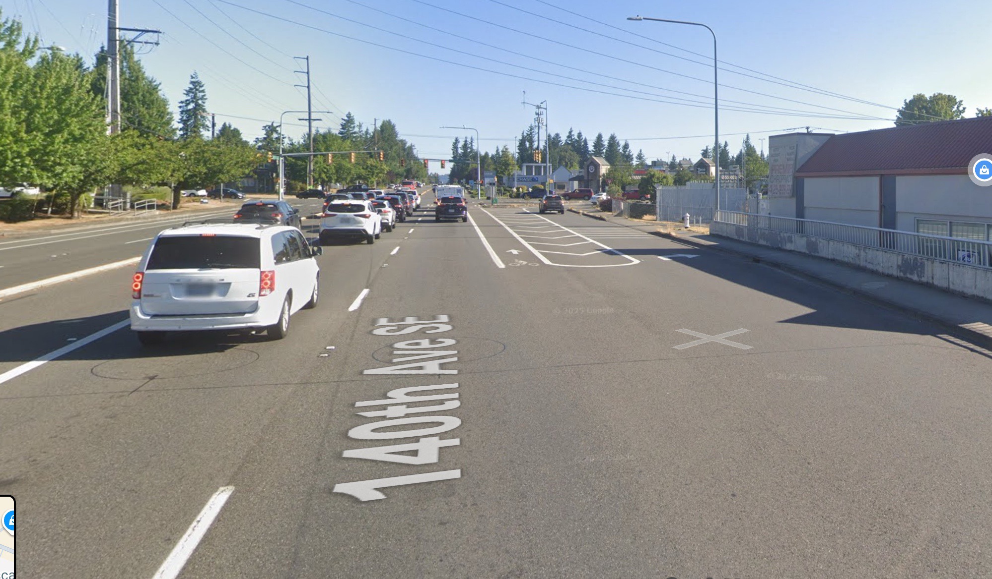
I then continued down the long gradually sloped hill along 140th to Cedar River Trail. 140th Ave does have a bike lane in the shoulder, but cars typically go 40-50 mph on this downhill.
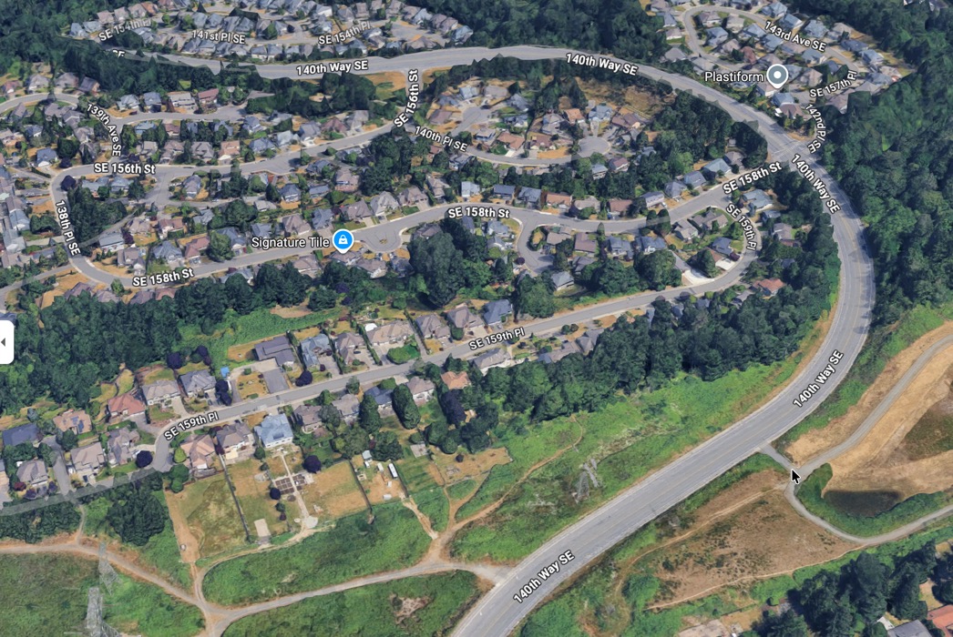
You can probably get up to speeds of 28+ mph on a bike down this hill, but I slow down at around 20 mph. There isn’t a protected bike lane on this hill (just a bike shoulder), so you have to rely on the cars to stay in their lanes. However, you’re going too fast to check a mirror behind you, and the curve of the road makes it difficult to judge their position anyway.
After I reached the hill’s bottom, I biked along Cedar River Trail (~2 miles of beautiful, fully protected multi-use trail) to the Renton Transit Center, where I caught Bus 101. While waiting at the RTC, I pumped up a guy’s flat tire for him. On the bus, instead of getting off closer to Seattle, I got off on Sodo Busway and Spokane St stop and tried biking up the new dedicated paths along the waterfront (Alaskan Way) for a nice ride into Seattle.
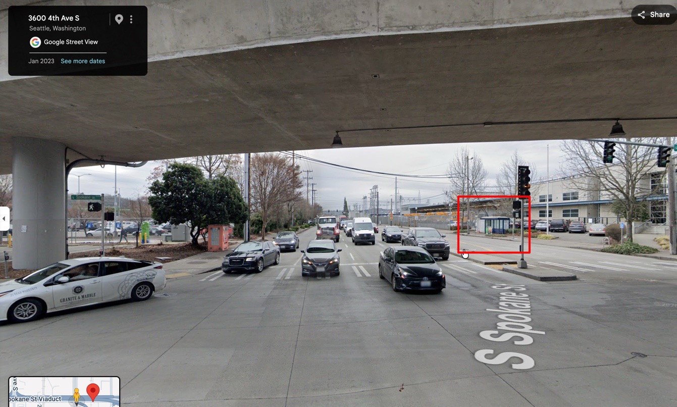
The roads on Spokane Street are heavily industrial and not bike friendly. South Spokane and Sodo Busway sits under an elevated highway that has many homeless encampments under it — probably 75+ tents. The whole area is an industrial zone, traversed by many elevated highways/freeways and train tracks. This isn’t where the tourists in Seattle go, but it’s close to the waterfront trail that was recently built on East Marginal Way. It’s feasible to bike along Spokane Street about half a mile along the sidewalks over to where the waterfront trail starts. However, riding east/west instead of north/south goes against the flow of traffic here and the lights are long. Expect to wait 5+ minutes at some intersections.
Before I could get to East Marginal Way, a freight train blocked my path (train yards are massive here too). After waiting 10 minutes for it to move, I gave up and rode up the Busway road to the Sodo trail, then biked up 4th Ave to my work in South Lake Union. The Sodo trail (1 mile) is short but helpful. It lets out near the Stadium area, which you can traverse safely along Occidental as a side street.
In the afternoon, on my way home, I biked down 2nd Ave (a protected bike path) and then jumped down to Alaskan Way from Spring Street. Then at the Spokane and Sodo Busway, I waited about 15 minutes for the 102 bus to arrive. I took the 102 rather than the 101 going home because it drops me much closer to my house, but it’s the tradeoff of a much less frequent route. Fortunately, Google Maps (the app on the phone only) sometimes shows the real-time location of buses along their routes, so I could know just where the 102 bus was and when it would arrive. When the bus arrived, I rode it all the way to Renton, getting off near 116th and 168th Ave. Then I rode home through backroads and side streets (for the most part).
The bus itself was fine — clean, easy to mount bike (though there’s only room for 3 bikes on the front rack), and room to sit down. However, the bus’s slow pace, with constant stops, meant I was on that bus for about 45 minutes. Factor in the 15-minute wait and it was a long time to be taking the bus. The stop-and-go motion wore on me, and everyone around me seemed tired and depressed.
Door to door, this route ran close to 2 hours each way: roughly 40 minutes of biking to the transit center, 15 minutes of waiting, 45 minutes on the bus, and another 25 minutes of biking on the Seattle end. This is a route you have to experience to understand. It’s not a route any cyclist would really enjoy, even though it’s doable.
Route 2 - 192nd St to the Tukwila Sounder station
| Feature | Assessment |
|---|---|
| Safety | Low |
| Time | ~1 hr 45 min each way |
| Enjoyment | Minimal |
This route involves biking directly to the Sounder station from my house, and then riding up 2nd Ave.
I live on a hill that’s about 500 feet in elevation higher than the surrounding area. This means it’s easy getting to the Sounder station, but much harder coming home. I typically drive down a steep twisty road (192nd St, pictured below). I also chose to bike down this same path, as cars drive it slowly and, when I’m going downhill, I can more or less keep pace with a similar speed as cars here.
Sponsored
So for this route, instead of biking down 140th Ave, I rode pretty much a similar route to the Sounder as I would drive — down the twisty 192nd St, though I cut through some parking areas (IKEA) instead of road sidewalks, and took side streets instead of main routes.
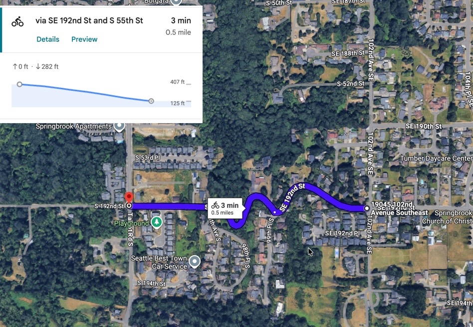
This stretch of 192nd is short, no more than half a mile. Going down is fine because cars only go about 20-25 mph here. On a bike the steep grade makes it feel like going downhill on a roller coaster.
The problem is that there’s no way to climb up this hill on a regular bike for the return ride home. It’s too steep — walking is faster. I had an ebike last summer and climbed this hill on it regularly, so it can be done with a motor, but I only ever did it in daylight. There’s no stable shoulder, so cars and bikes share the same path, which makes it dangerous when visibility drops.
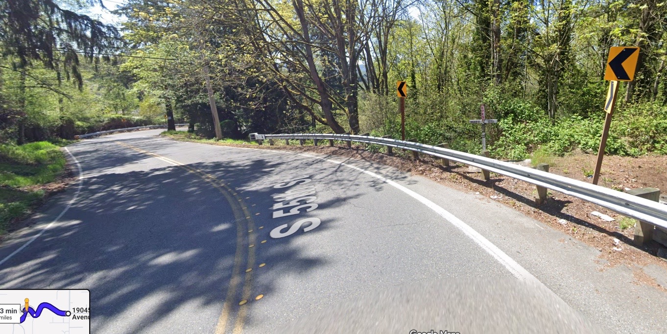
Because I can only bike down this hill (one way), I didn’t want to cement this as my regular route. There aren’t any other side street options here. Forests create a barrier with no alternate routes — I’ve looked for hours (both on maps and driving around). The next street up (SE 200th ST) is more of a gradual climb, but there’s no consistent bike shoulder there either, and there’s more traffic.
It turns out I’m not the first person to notice this. Renton’s own Trails and Bicycle Master Plan (PDF), adopted in January 2019, names these exact streets. The Benson Hill section lists the “bicycling problem spots” residents identified as “Benson Road S, SE 192nd St, 108th Ave SE.” The Talbot section flags “the hill between SE Carr Rd and SE 200th St” as a walking problem spot and notes that “SE 200th was also identified as a bicycling problem spot.” One resident comment in the plan is blunt: “There is no way to get up and down the hill safely between Carr Rd. and SE 200th St…. That’s a 1.25-mile sidewalk desert.”
So both options I found — the twisty road I can only ride downhill, and the gradual one with no shoulder — were flagged by residents years ago. Another comment in the plan sums up the hours I spent staring at maps: “Best bike route up Benson Hill is not clear.”
At the bottom of the hill, you ride north along Talbot Rd S over to S Carr Road near the Valley Medical Center, taking a shortcut underpass that takes you to the Medical Center entrance. Exit the entrance back out to Carr road. As soon as you get to Carr Road, you have to traverse through dense car-centric routes with no protected bike lanes. While this route is do-able, it’s not enjoyable. In the morning, everyone is rushing to work and it’s not a great time to be on a bike next to them.
The geographical problem with Renton (this part of Renton anyway — Renton is huge) is that there are limited crossing points over Highway 167. This makes it so everyone has to go across S 43rd St / 180th St. (BTW, the road names are also really confusing. S43rd / 180th / Carr / Petrovitsky are all the same road, just different stretches.) The following image shows that the only way across Highway 167 is by taking 180th St, which is car-dense and has no bike infrastructure.
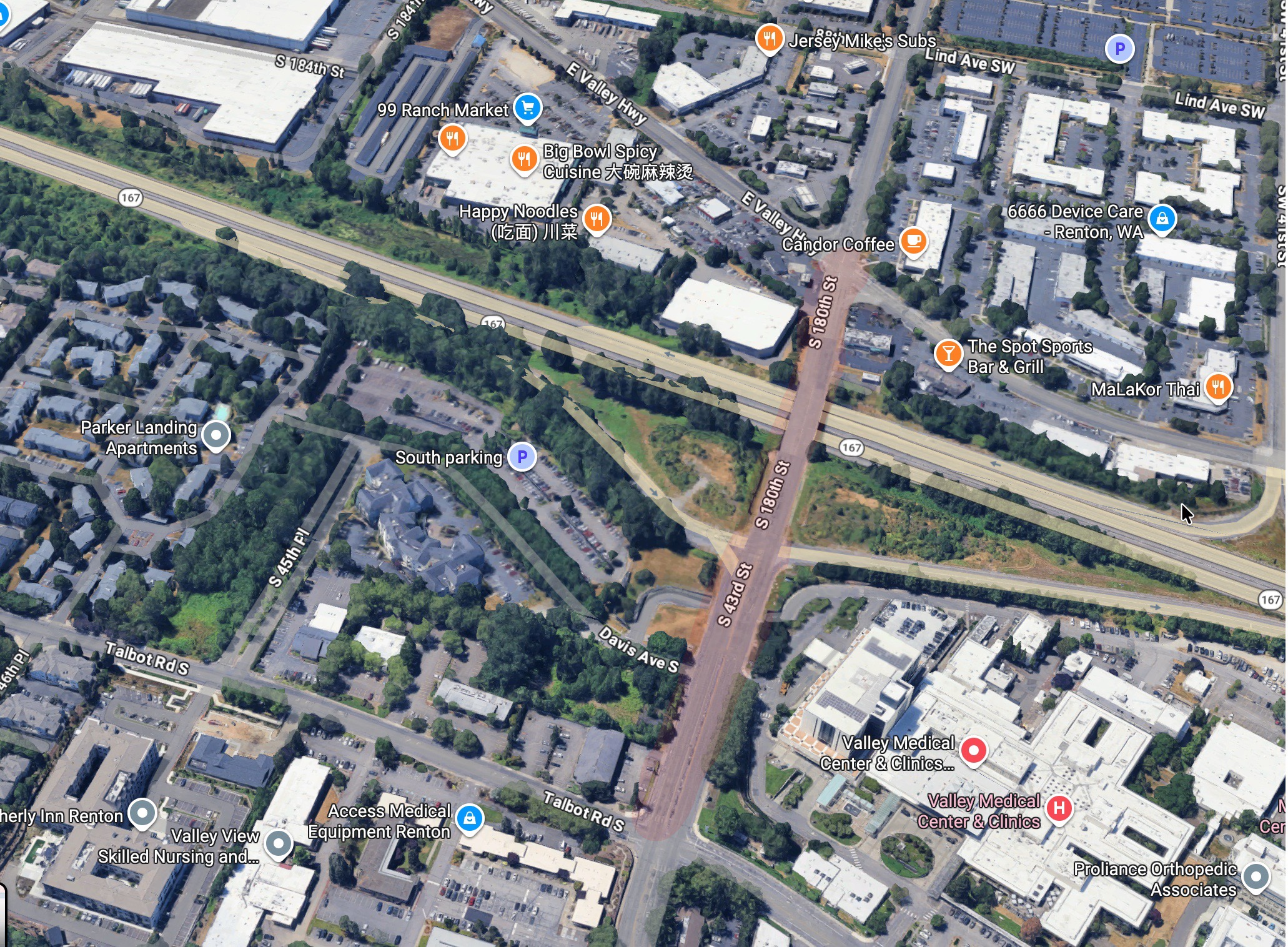
On these stretches, you have to ride on the sidewalk.
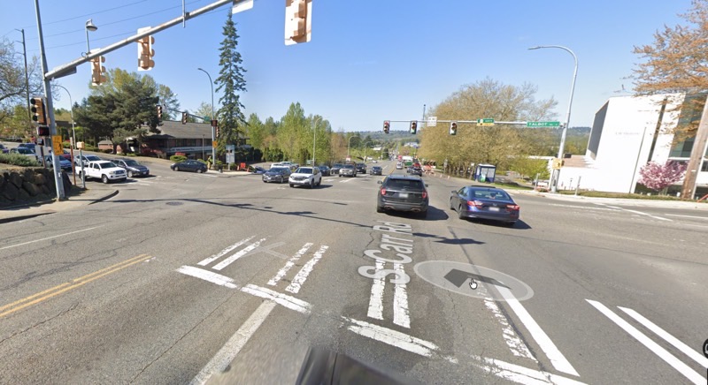
There aren’t any side street options across Hwy 167.
The master plan corroborates this stretch too. In its Valley section, it reports that “community input identified locations along SW 43rd St as problem spots for walking and biking,” and that the specific bicycling trouble spots along that street “include: S 180th St, SW Grady Way, Oakesdale Ave SW and SW 7th St.” That’s the crossing I’m describing, named by residents in the city’s own planning document.
On my return home in the afternoon, I biked from South Lake Union down 2nd Ave to King Street Station, then took the Sounder to Tukwila (mostly retracing my morning route). But now how to get up the big hill? I rode side streets up Carr/Petrovitsky road and then, after a bit of hill climbing, stopped at a bus stop near Valley Medical Center and took the 906 bus to 140th and Petrovitsky (the top of the hill). This is the only sane way to climb the hill without being a much more fit/intense cyclist or riding an ebike.
Fortunately, the timing between getting off on the Sounder and the 906 bus stop was relatively close (within a ~10 minute wait). However, I’m pretty sure that the connection between getting off the Sounder and biking to this 906 stop has only one feasible connection point throughout the day. All other times, you’d wait 20-30 minutes between getting off the Sounder and connecting to the 906.
BTW, mapping these connection points is notably challenging, which is why I never want to rely on two legs of public transportation. Invariably one leg is late and misses a connection, or you arrive extra early to ensure you don’t miss the connection. Either way, there’s a lot of dead time waiting.
The ride on the 906 took about 15 minutes. Then I biked the last 1.7 miles to my house, descending about 125 feet — my house sits a bit below the crest of the hill, even though the Fairwood area as a whole sits well above the valley floor.
This route came out around 1 hr 45 min each way. It’s the fastest of the three, but only because the Sounder does the heavy lifting, and it depends on connections I can’t control: the train runs on a commuter schedule, and the 906 that saves me the climb home lines up with it maybe once a day.
Route 3 - Drive to Van Asselt park, bike rest of way
| Feature | Assessment |
|---|---|
| Safety | Medium |
| Time | ~1 hr 40 min each way |
| Enjoyment | Medium |
This route involves using a car and cutting out public transportation, since much of public transportation involves waiting for the bus/train to arrive.
While I still had my car, I drove down to Van Asselt park area because it sits at the southern end of the Chief Sealth trail and parked in a residential area. Then I biked along Chief Sealth trail, then up Beacon Ave, which has a good bike lane. Recent improvements have added curb protection along much of the bike lane on Beacon Ave, making it much more feasible as a biking route north through South Seattle.
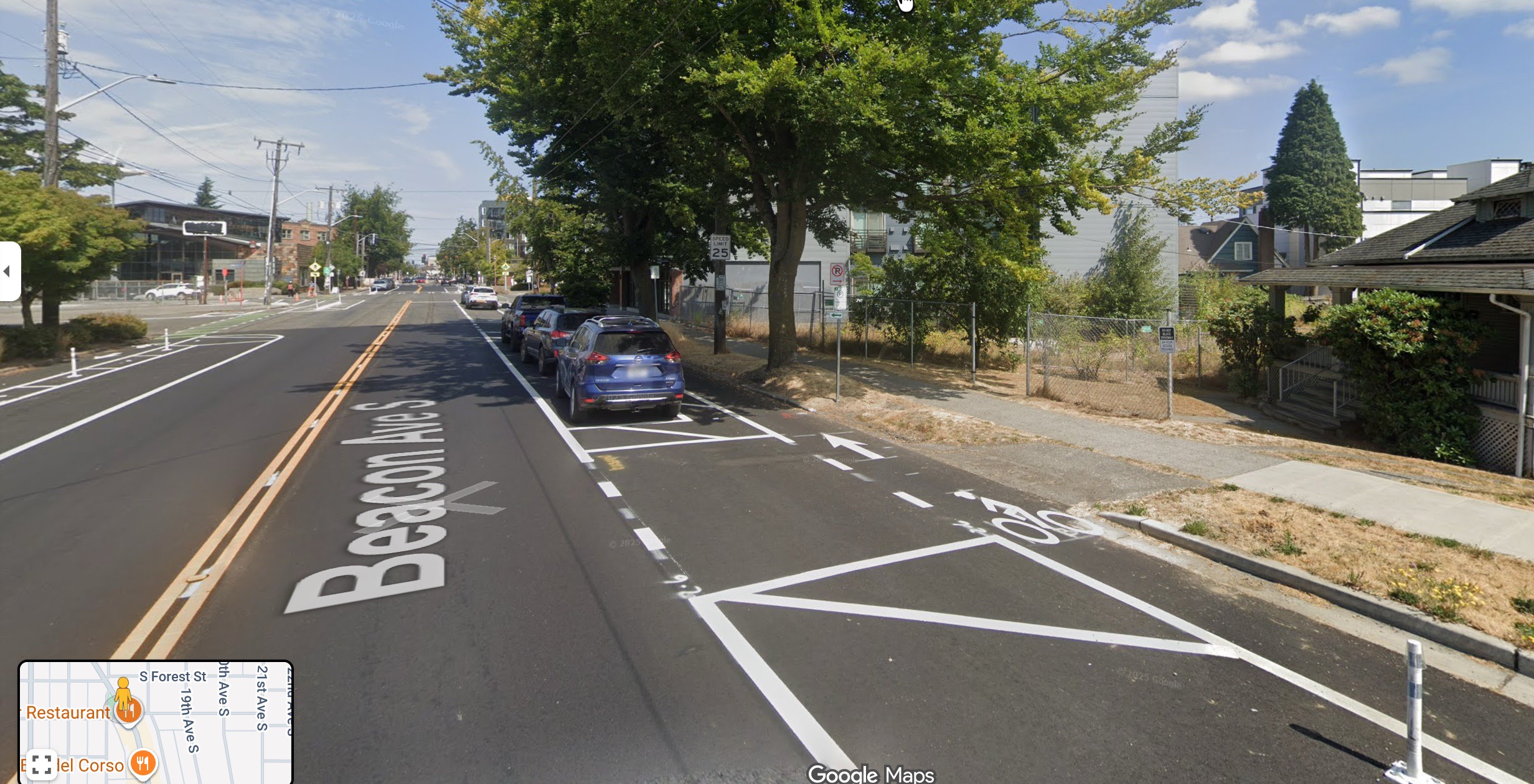
This is the right way to do a bike lane — put a row of parked cars between the edge of the road and the bike lane. It feels much safer, especially when you include little pop-up poles as a visual barrier as well. Beacon Ave is a genuinely bikeable route, and the one stretch in this whole experiment I looked forward to.
However, driving up to Van Asselt park took around 45 minutes during rush hour. I then spent another 10 minutes figuring out where to park. On my return ride home, I spent around 20 minutes looking for my car. I failed to follow this best practice: park near an easily recognizable landmark. Chief Sealth trail has many different entry points, and what I thought would be easy (S Brighton and 32nd) was much more confusing, especially in low light.
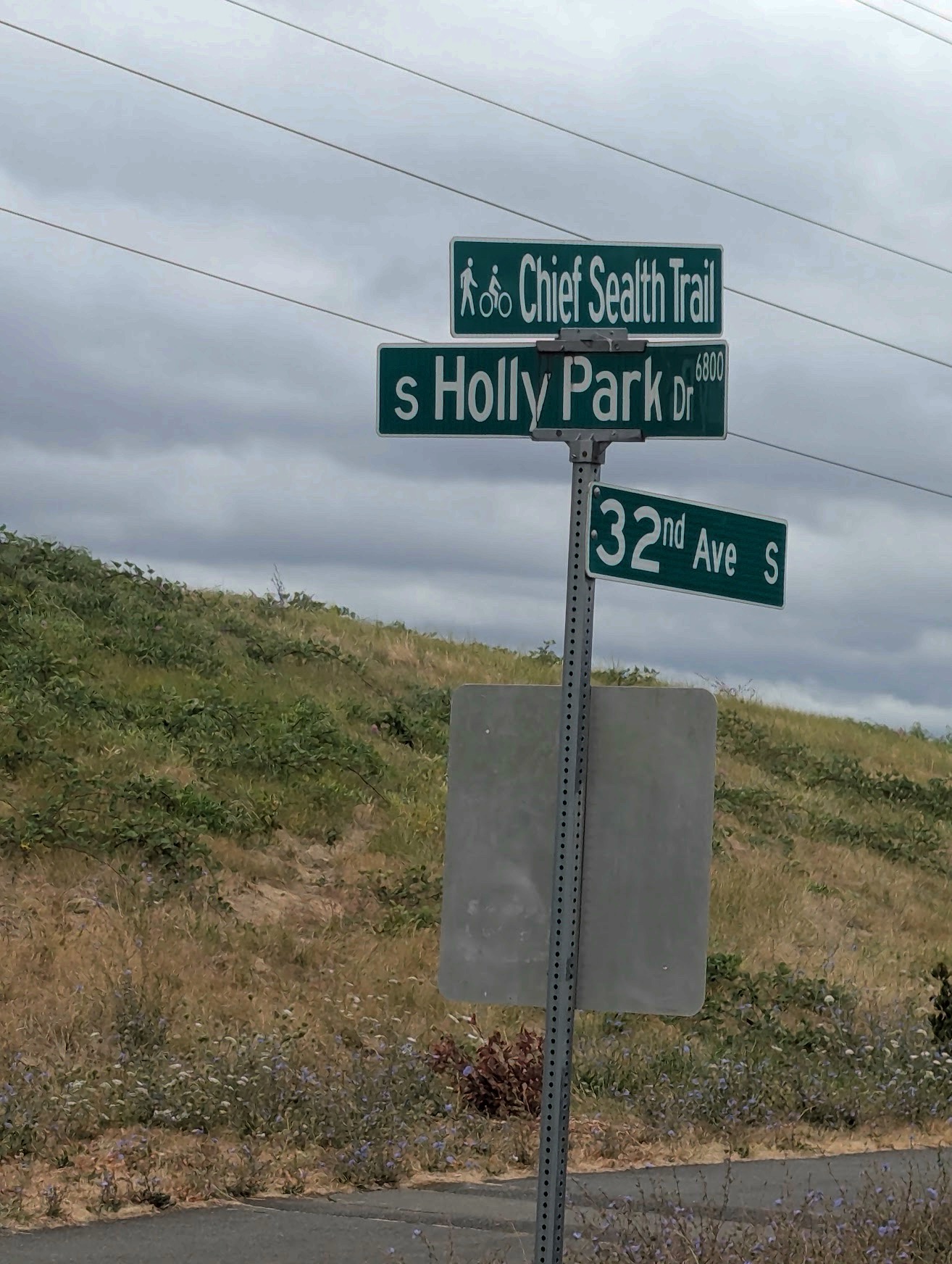
The problem with this route is that it took so long to drive up to Van Asselt park and find parking. Presumably, I could find a more efficient entry point, perhaps cutting it down to 40 minutes. But the ride from here was another 45 minutes up to South Lake Union. This gets to the crux of the problem: time. Spending 45 minutes driving + 45 minutes biking = too much time commuting.
Overall verdict
Here’s how the three routes compare, along with the two options I already had:
| Route | Time each way | Safety | Enjoyment |
|---|---|---|---|
| 1. 140th to Renton Transit Center, bus to SODO | ~2 hrs | Low | Minimal |
| 2. 192nd St to the Tukwila Sounder station | ~1 hr 45 min | Low | Minimal |
| 3. Drive to Van Asselt park, bike the rest | ~1 hr 40 min | Medium | Medium |
| My usual route: drive to the Sounder, bike from King St. | ~1 hr 10 min | Medium | Moderate |
| Driving the whole way | ~50 min | n/a | n/a |
I was trying to make my commute double as bike exercise, but I realized that I couldn’t achieve this without sinking a lot more time into my commute than I wanted to. It’s not feasible to spend almost 2 hours each way getting to and from work. I ended up distracted from work; the day’s work hours seemed shorter and I wasn’t getting anything done.
I don’t think this is just me. In 2023, Cascade Bicycle Club staff took part in a Week Without Driving and wrote up what they learned. One of them, Zack Kravey, lives in Renton and commutes about 25 miles to Magnuson Park — a trip with a similar shape to mine, though he rides an ebike. He tried to plan a bike-plus-light-rail combination and abandoned it: his ebike was “too heavy to use the vertical hangers in the light rail,” and the trip “would have taken me double the amount of time as opposed to just biking the entire way.” Without a car, he wrote, he’d have needed “2 buses and the light rail to get from Renton to Magnuson Park,” and concluded: “This wouldn’t be sustainable and I am nearly certain that I would not be able to work at Cascade solely due to the difficulty of the commute and time lost that I could otherwise be spending with my family.”
That’s someone whose actual job is bike advocacy, riding a motor-assisted bike, landing where I landed.
Additionally, these bike miles aren’t pleasant biking miles. It’s not where I want to spend my biking hours. When I’m on a bike, I want to be on a protected path, not a side shoulder next to angry, fast-moving cars. Biking in Seattle (on the protected bike paths) is much more feasible than biking in Renton.
It’s also worth remembering that I ran this experiment in late August, on dry roads with daylight at both ends of the day. That’s as good as it gets here. Fall is coming, and with it rain and darkness on the evening ride home — on shoulders with no separation from traffic, on a hill I said I’d only climb in daylight even with a motor. If the routes don’t work in the best conditions of the year, they aren’t going to work in November.
Kravey described the same problem from his side of the county: almost none of his route has lighting, and on the “fall and winter 5 p.m. commute home half in the dark,” he doesn’t “feel easily seen by drivers or other cyclists,” even with a headlight. That week, he biked once and left early to get home safely.
So I decided to buy a car. I’ll probably continue my previous route of driving to the Sounder, getting off at King St. Station, and biking the rest of the way (a two-mile short ride). In part, timewise this is still decent. When the train is on time (about 75% of the time), it’s fast, and I can either bike or take an escooter for the last leg.
I might also just drive all the way. Driving from home to South Lake Union only takes around 50 minutes. However, it’s much more costly, as I lose out on $7 commute incentives, pay $8 to park at work (my work charges for parking Monday through Thursday; Friday is free), pay another $4 in tolls, and $7 in gas. This means driving costs about $25 a day, or $500 a month. Is it worth $500 to save 20 minutes each way? Sometimes the drive home is longer. Driving is also more stressful (for example, just last month I got in a car accident on Hwy 167), and sitting so long makes my back hurt.
Instead of trying to squeeze in longer bike rides in the morning, I’ll instead do the group fitness classes offered at my work. I think those fitness classes (body strengthening and body conditioning) offer a better workout anyway. I’ll save weekends for recreational rides.
Lessons learned and recommendations
To Renton city officials and transportation planners: bikeability in Renton remains a major hurdle. These bike miles currently aren’t pleasant or safe. Specific infrastructure improvements are needed: protected bike paths rather than shoulder lanes, and safe crossing points over Highway 167 (such as along S 43rd St / 180th St) to connect eastern residential areas to transit hubs without forcing cyclists onto high-traffic sidewalks and dangerous intersections.
The frustrating part is that none of this is news to the city. The master plan’s executive summary says it plainly: “Renton has some LTS 1 & 2 routes, which are in Kennydale, Cedar River, and the Valley. Most of the community is not served by LTS 1 & 2 routes that offer off-road trails or dedicated and separated bicycle lanes.” (LTS is “level of traffic stress”; 1 and 2 are the low-stress facilities that ordinary people will actually ride.) The plan names Benson Hill — my area — as one of two Community Planning Areas that are “currently largely underserved,” and quotes a resident saying what took me three routes to learn: “It is too difficult, and dangerous, to bicycle through Renton to connect to major trails leading north, south, and east.”
That plan was adopted on January 28, 2019. It set a target of growing LTS 1 & 2 trail miles in Renton from 23.3 in 2018 to 113 by 2035. Seven years into that timeline, getting out of my neighborhood by bike is still a choice between a road too steep to pedal up and a road with no shoulder.
Two things I’d add to the plan. First, it has almost nothing to say about Highway 167. The freeway comes up twice in 166 pages, both times only as context for transit routes — there’s no treatment of bicycle crossings over it at all. But those crossings are the bottleneck that decides whether anyone on this side of the valley can reach the Sounder station or the Valley by bike. Safe crossings over 167 would do more for bike commuting from east Renton than almost anything else on the list.
Second, some of this isn’t Renton’s to fix. The plan notes that “the Fairwood planning area is excluded as it resides entirely outside the City” — much of the area I’m describing is unincorporated King County, and my routes cross back and forth over that line several times before I ever reach Seattle. Which is its own version of the problem: the ride doesn’t care where the boundary is, but the planning does.
Related posts about biking
I’ve been circling this same question for a long time, in three different states:
- Biking to Work – A Good Idea, But … — my first attempt, on a 15-mile commute in Utah. Trail gaps, winter, and a two-and-a-half-hour round trip led me to the same conclusion I reached here: the company gym is the more realistic way to get exercise.
- Finally Biking to Work — the follow-up, where I tried driving to a trailhead and riding the rest of the way. That’s the same hybrid strategy as Route 3 above, and I ran into the same problem: trails that end abruptly with no connection.
- Trying New Things, Changing Interests — on how biking became an interest in the first place.
- The most perfect 17-mile biking loop in Santa Clara — what I’d rather be doing with my bike hours, which is more or less where this post lands.
About Tom Johnson
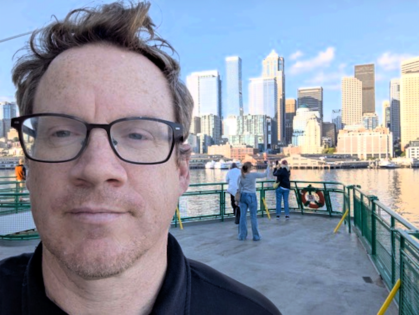
I'm an API technical writer based in the Seattle area. On this blog, I write about topics related to technical writing and communication — such as software documentation, API documentation, AI, information architecture, content strategy, writing processes, plain language, tech comm careers, and more. Check out my API documentation course if you're looking for more info about documenting APIs. Or see my posts on AI and AI course section for more on the latest in AI and tech comm.
If you're a technical writer and want to keep on top of the latest trends in the tech comm, be sure to subscribe to email updates below. You can also learn more about me or contact me. Finally, note that the opinions I express on my blog are my own points of view, not that of my employer.